
Inspiration is Everywhere (some of our favorite hiking trails)
Recharging one's batteries (so to speak) is essential to me as an artist. Getting out and hiking is the best way to "reboot" my system. Get some fresh air and miles under my belt and creativity just flows naturally. Maybe everyone is that way but I've always had to get out and breathe, you know?
And because with an open painting studio in Asheville's River Arts District, I am sometimes the unofficial town greeter, and am asked about fun things to do (including hiking). So it seemed like a good idea to share some of my favorite hiking trails around here.
Dupont Forest Waterfalls
This three-mile hike to two awesome waterfalls is the most popular waterfall hike near Asheville and one of my favorites. The moderate hike has a few hills but is perfect for about all fitness levels and families. Since it's so popular, weekends especially in the summer and fall bring big crowds.
Triple Falls
Triple Falls has three cascades with a total 120-foot drop. Just past an overlook, a trail forks off to the left and heads down to land on a large rock area below the top two falls and atop the third. It's a great place to relax or have a picnic, while you enjoy the views up and down the waterfall.
High Falls
From Triple Falls, continue about 1/2 mile on the High Falls Trail to the largest waterfall, a 150-foot cascade down an inclined plane of granite. En route, you'll see the River Bend Trail to the left. Take this detour to reach the base of High Falls (includes rock hopping along the river).
Black Balsam Knob
A must hike along the Blue Ridge Parkway (milepost 420.2, about 26 miles from the Asheville exit on the Parkway) is the Black Balsam Knob area that includes some of the most spectacular mountain balds in the Southern Appalachians, including Black Balsam Knob (or Black Balsam Bald), Sam Knob, and Tennent Mountain. These treeless mountaintops in the Pisgah National Forest draw people from all over to soak in the sweeping views with an alpine-like feel. Almost entirely devoid of trees above 6,000 feet elevation, the summits are more reminiscent of New England than North Carolina.
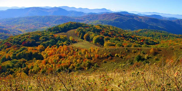
Max Patch
This 4,600-foot mountain was cleared and used as pasture in the 1800s. Today, it's a 350-acre tract of open land on a high knob with 360-degree views. On a clear day, you can see from Mt. Mitchell on the east to the Great Smoky Mountains on the south. What a picnic spot! And great for star gazing and enjoying wildflowers. The summit is a short walk from the parking lot. Max Patch is part of the Pisgah National Forest. The Great Smoky Mountains, only 20 miles away, dominate the southwest horizon. To the west the terrain drops more than 3600 feet into the flatlands of eastern Tennessee. To the west 50 miles, rises the dark ridgeline of the Black Mountains. Endless ridges and peaks fill every vista.